Loading document...
Planning Statement Applica on for change of Use from Agricultural Land to Residen al Cur lage (Garden Land) Sites: Hillside, Orrisdale, Fairview, Cronk My Chree, and Mount Pleasant, Colby Local Authority: Arbory
This Planning Statement supports an applica on for the change of use of a sec on of land from field 424837 situated to the rear of the proper es known as Hillside, Orrisdale, Fairview, Cronk My Chree, and Mount Pleasant in Colby. The proposal seeks permission to change the use of this land from agricultural to residen al cur lage, enabling it to be incorporated into the exis ng gardens of the five aforemen oned dwellings.
The site is located along the main road through Colby and directly adjoins the rear boundaries of the five exis ng residen al proper es. The land was historically part of a larger agricultural holding field 424837 formerly owned by Mr. Ken Gawne and used for mixed agricultural purposes, including grazing of livestock and cul va on of crops.
The parcel of land forms a natural extension of the exis ng domes c plots, being immediately adjacent to established residen al cur lage and separated from the wider agricultural land by exis ng field boundaries and fencing erected by Mr. Ken Gawne to ensure it complies with standards for ca le and such like.
The total area of land is approximately 314.5 sqm. Please see photo L which displays the site measurements.
The proposed appor onment of land has been designed to follow the exis ng side boundary lines of each individual dwelling. This approach maintains the established pa ern of ownership and ensures that the extensions to the rear gardens align naturally with the current plot configura on.
Ownership of the land was transferred from Mr. Gawne to the five respec ve homeowners on 16 February 2024.
The proposal seeks to formalise the change of use of the land from agricultural to residen al cur lage. The land will serve solely as extended private gardens associated with each property. No buildings, structures, or hard landscaping are proposed as part of this applica on.
Intended uses include general garden amenity, lawned areas, plan ng, and informal recrea on. The change of use will not alter the character or appearance of the locality, and all exis ng boundary treatments will be retained or enhanced as appropriate.
The proposal accords with local planning principles under the Arbory and Rushen Local Plan, which supports minor changes of use that enhance residen al amenity without adversely impac ng rural character or agricultural viability.
Key considera ons:
The proposed change of use from agricultural land to residen al cur lage represents a modest and appropriate adjustment to reflect the current ownership and intended use of the land. It will provide a posi ve enhancement to the residen al proper es, ensure ongoing maintenance of the land, and will not adversely affect the surrounding rural or residen al character of Colby.
The proposal is therefore considered to be consistent with the aims and objec ves of the relevant planning policies of the Arbory local authority, and approval is respec ully requested.
Taken from the rear of Fairview, overlooking Orrisdale & Hillside. The barbwire fence also displayed erected by Ken Gawne.
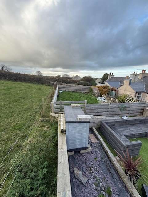
Photo C – Rear of Hillside
Photo exhibi ng the corner triangle which belongs to Hillside. This will be integrated into the exis ng garden in due course.
Taken from the rear of Fairview, overlooking Cronk My Chree & Mount Pleasant. Photo D – Rear of Orrisdale Photo to display the rear of Orrisdale, fenced the same as Hillside, currently used as a grass area for plan ng.
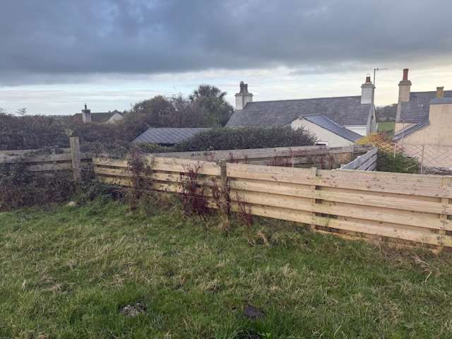
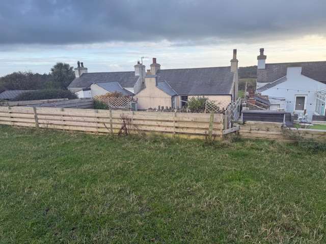
Photo E – Rear of Fairview
Photo revealing the rear of Fairview, with a surrounding wall built using sleepers. The extended garden has been used as a func onal outdoor space for sea ng and children’s play.
Photo F – Rear of Cronk My Chree Picture displaying the rear of Cronk My Chree, high fencing has been erected to create an enclosed garden area suitable for pets. Photo G – Rear of Mount Pleasant
Photo presen ng the rear of Mount Pleasant. Par oned with a block wall. The extended garden has been absorbed into the exis ng and is to be used as a func onal outdoor space.
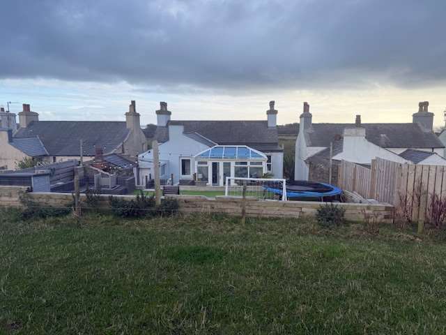
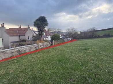
Photo H
The red line shown on the photograph demonstrates that the garden extensions will con nue the exis ng garden line established by neighbouring proper es.
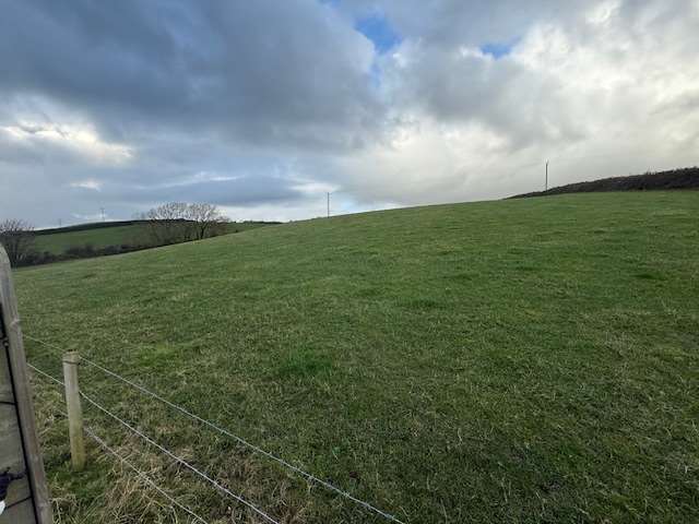
Photo I
Photo of the field owned by Mr Ken Gawne which abuts the 5 proper es.
Photo J
The image illustrates an aerial view prior to the change in land ownership.
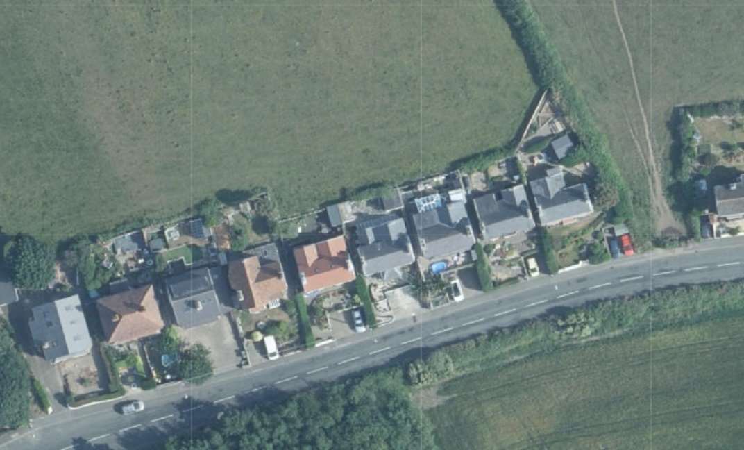
Red line indicates the proposed residential curtilage which is now owned by the applicants.
Site measurements shows the total length at 52m to the widest point and starting at Mount Pleasant 5.9m in depth and by Orrisdale 6.5m in depth, demonstrating the tapering of the land to keep in line with the existing gardens to the west.
Copyright in submitted documents remains with their authors. Request removal
View as Markdown