Loading document...
Location:- The Perch 3 Collins Lane, Ramsey, Isle of Man, IM8 1AL
Proposal:- Conversion from Commercial to Residential Use.
1.1 The owners of 3 Collins Lane (The Perch) Ramsey have instructed Matthew Reed Bsc Hons FAAV of Deanwoods, Ramsey to undertake a flood risk assessment; as requested by the Mr Visigah the planning officer managing application number:- 23/00421/B Conversion from Commercial to Residential Use.
As described within the Design and Access Statement the property is a vacant commercial property.
Defended gently sloping street falling slowly towards Parliament Street at the flood gate adjoining the Quay at footpath level.
One access point from the Quay is defended with a flood barrier, the remainder of the site is defended by surrounding buildings (Penketh Millar building and further tidal barriers up and down stream).
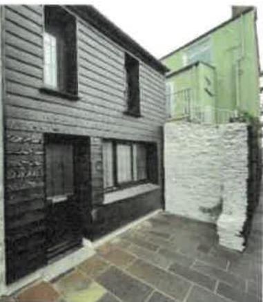
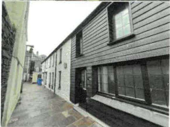
Due to Manx stone construction the only ingress point to the building is through the front door accessing the street (to be defended by its own flood gate for good measure) the rest of the lane facing wall is safe from flooding up to the windows sills.
According to the Isle of Man Flood Risk Viewer Collins Lane is a High-Risk Tidal Flooding area only. Meaning ‘in the case of flooding from the sea, the flood maps indicate the extent of a flood with a 0.5% (1 in 200 year chance of happening in any year. (These maps take into account climate change.)’ (A more detailed Flood model is considered latterly in this report)
The site was measured with the results highlighted below:-
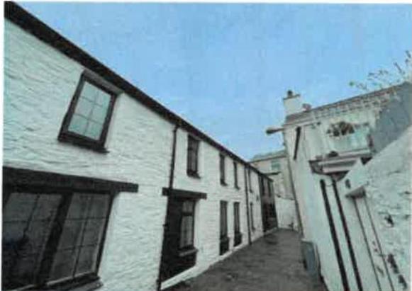
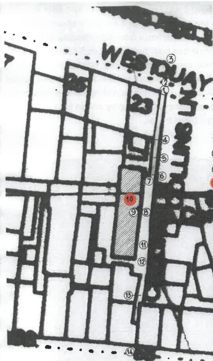
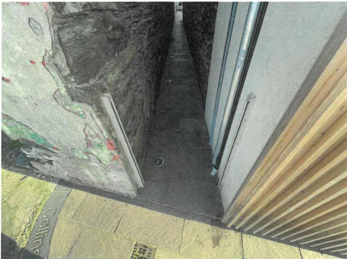
LEVELS IN COLLINS: LANE TAKEN ON TOP OF PAVED SURFACES — ALL LEVELS IN METRES. {{image:7299942}} Pictures of the street scene are below
Number of residential dwellings and commercial properties as described in the design and access statement application.
The Ramsey West Quay Flood Defence Modelling Technical Note 2019s0299 by JBA Group Written for The Isle of Man Department Of Infrastructure referenced below is publicly available, it is recommended that a copy is printed, so to corollate the referenced data throughout this report.
The study covers the proposed site, and was designed to assess if the sea wall protects to a suitable level Ramsey from tidal flooding, and in the scenario there is an extreme rainfall event; this included Hydraulic model sensitivity scaling by 30% the 100 year river flows in line with IOM guidance. (section 3.4) and peak tidal flows represented the 2119 projected tidal curve levels of 5.63mAOD. The data has inbuilt 20% sensitivity.
Ramsey West Quay Flood Defence Modelling Technical Note 2019s0299 by JBA Group Written for The Isle of Man Department Of Infrastructure. Section 1.2 highlights the study area more than covering the proposed site.
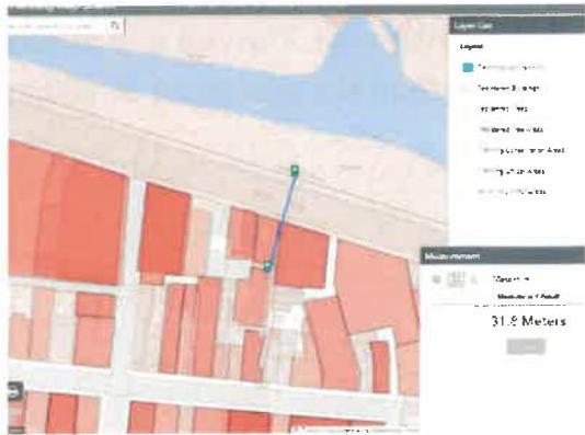
The distance to the Sulby river high water mark is 31.8 meters away from the site.
2.2.4 Relevant Information from the Ramsey West Quay Flood Defence Modelling Technical Note 2019s0299 by JBA Group Written for The Isle of Man Department Of Infrastructure.
Figure 2.1 of the Technical Note shows that the 1,000 year baseline modelling projects no flooding from the River Sulby.
The River Litney is culverted, therefore the site is protected as highlighted by the Isle of Man Flood Risk Viewer from Surface water flooding. The Technical note also highlights under 2.2 that the site is outside of the 100 year baseline plus climate change for surface water flooding.
Under Appendix A, if a sea wall was put in then the site would be unaffected by fluvial flood mechanisms designed to allow the flow from the River Litney to escape.
Helpfully, the figure 2.2 also highlights that a the site would be defended to a 1 in 1000 year event should the proposed wall be in built.
As the risk of flooding is considered to be from tidal flooding Figure 3.2 tidal projections provides some interesting results.
The ground level of the wall is 4.4 meters compared to the 2119 projected tidal curve levels of 5.63mA (with 20% sensitivity). The red line proposed wall, if built would defend the site to a 1 in 1000 year event (yellow area).
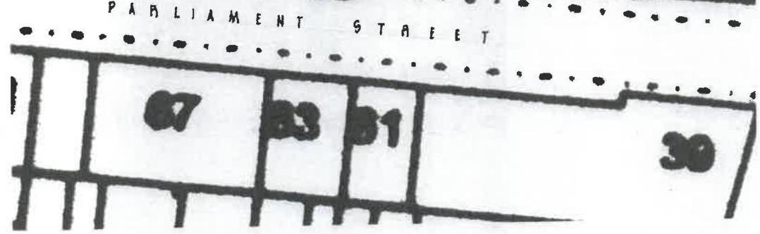
1-100.005 AT FRONT CORNER OF 25 WEST QUAY. 2-99.995 ON HOTPATH ADJ. TO WEST QUAY. 3-99.895 ON WEST QUAY. 4-100.000 IN LANE AT END OF 23 WEST QUAY. 5-100.001 IN LANE AT END OF YARD NO. 23. 6-100.035 IN LANE AT CORNER OF 'PERCH'. 7-100.130 IN LANE IN FRONT OF 'PERCH'. 8-100.125 AT FRONT DOOR OF 'PERCH'. 9-100.160 INNER LANDING AT 'PERCH'. 10-100.000 FLOOR LEVEL IN 'PERCH'. 11-100.110 IN LANE AT END OF HOT-DOOR BUILDING YARD. 12-99.975 IN LANE AT END OF 'PERCH' BUILDING. 13-99.905 IN LANE AT END OF DIAMONDD MEETS. 14-99.925 ON HOTPATH IN PARLIAMENT GENET.
LEVELS IN COLLINS LANE TAKEN ON TOP OF PAVED SURFACES — ALL LEVELS IN METRES.
PARLIAMENT GENET
The flood gate at point 1 was laser measured to be 1.05m above point A which is 1m above the ground level of 4.4 meters. Meaning there is currently an effective flood defence from tidal flooding to 6.45m this exceeds the 2119 projected tidal curve levels of 5.63mA (with 20% sensitivity). Therefore, currently the site is protected in excess of a 1 in 1000 year flood risk (which is quoted to be in figure 3.2 (red dotted line to be 5.1m AOD). Similarly, when incorporating climate change the current defences exceed the 200 year (grey dotted line) projected levels of 5.63. flood gate pictured below.
As described the lane facing wall has one weak point, the front door. The Manx stone wall is flush to the windowsills. Above street level each window was lazer measured to be 0.58m, 0.83m, 0.64m, 0.62m, 0.59m, 0.68m. Pictured in section 1 of this report the minimum height from the 4.4m base level of the current wall is 6.09m.
At point 8 of our measurements the front door without a flood gate, at the level of the door entrance totals 5.53m above the current 1,000 year flood risk level (red dotted line) and is extremely close to the 100 year plus climate change level (black dotted line) of just above 5.5m even without the flood gate; consequently even without the flood gate the property is suitably well defended from tidal flooding (including climate change).
2.2.5 Relevant information from the Ramsey West Quay Flood Defence Modelling Results for 2019s0299 by JBA Group Written for The Isle of Man Department Of Infrastructure What where they commissioned to assess.
Further backing up the above table 2.3 of this report highlighted that the present day peak tidal levels to a return level of 1000 years are expected to be 5.08mAOD, based on UK climate projections based on a timeline between 2081 and 2100. This is lower than the current flood gate height.
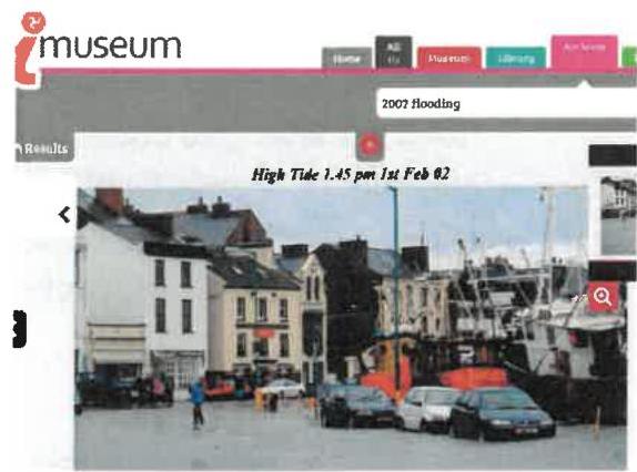
2.2.6 Flooding History. 1st February 2002 flooding occurred in Parliament Street
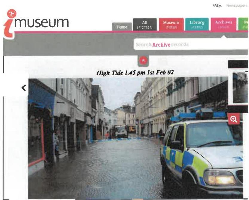
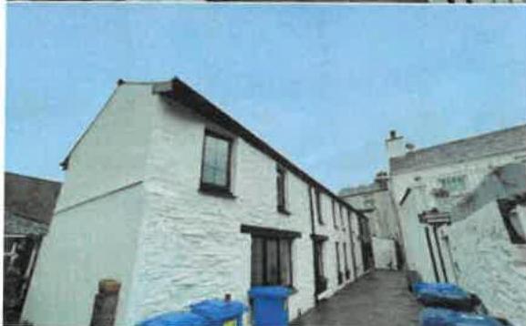
{{image:7299951}} Since the flood barriers have been put into place. There has been no recorded flooding of the existing building or street.
Further flooding in the locality occurred according to the Britannia Hotel application FRA and Former Mart site to be on the 3rd January 2014. This was described to be at 4.76m AOD (below the level of Collins Street), this was 0.3m below the pavement and the proposed ground floor level of 0.68m AOD. Nor was there any flooding on the Mart site who’s level AOD is 4.76 at the junction between Cooerage Lane and Derby Road.
A BBC article described the flood risk measures including 10,000 sandbags and the below flood barriers.
Commodities in coastal areas have been advised to get flood detection in place
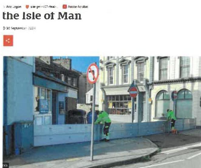
Further alerts have been reported in the news for the potential for high tides on the 22nd March 2023 & 29th September 2023. No issues where reported, plenty of prior notice enabled the flood defences to be put in place.
Conversion to full residential use, into a single dwelling, not changing the current footprint.
The site is in a tidal flood risk only, however it is found that there is sufficient levels on the site to prevent potential tidal flooding issue within the expected climate change parameters. There have been no reported flooding issues within the property in the past.
Furthermore, flood warnings for tidal flooding and heavy rainfall are given by the Isle of Man Met Office are between 12 and 16hr warnings. This gives sufficient time to activate the Ramsey flood barriers.
The aforementioned flood warnings provided in 2023/24 have allowed for the barriers to be put in place and for there to be no flooding issues in general in Ramsey.
Consequently, it is not considered necessary for internal mitigation, (not withstanding this, this can be negotiated), but out of precaution it is proposed to put a flood gate on the entrance door, which can be conditioned.
The design will be an Aluminum Nautilus barrier (or similar approved) to be specified in accordance with manufacturer instructions.
A flood management plan is to be implemented, this will include responsibility holders, monitoring of weather and tide patterns, and enact mitigation measures before, during and after any flooding events should they arise; also maintenance of the gate.
Copyright in submitted documents remains with their authors. Request removal
View as Markdown