PLANNING STATEMENT FOR THE CONVERSION AND EXTENSION OF BALLAKINDRY MILL, BALLAGAWNE ROAD, BALLABEG, ARBORY IM9 4PD
1.0 Introduction
1.1 Ballakindry Mill is an existing building which sits on the north eastern side of the B43 Ballagawne Road which links Ballabeg with the A27 Colby Glen - Ronague Road. The mill is partly intact, the roof and part of the upper walls having been recently removed to commence an approved renovation and conversion scheme (see Planning History).
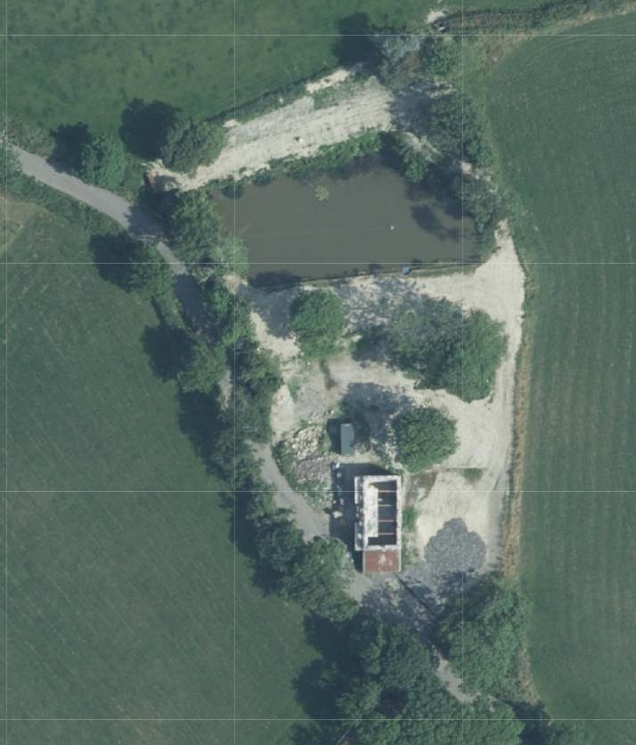
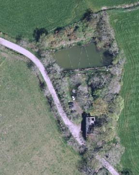
1.2 The site extends to the north of the building and the land associated with the mill is around 0.4ha. To the north there is a large lake and there are trees around the western edge of the site with others within the site and in the north eastern corner.
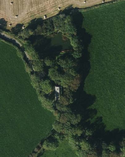
An aerial satellite view of a rural site showing a building complex, a pond, and surrounding agricultural fields with a grid overlay.
1.3 Planning approval has been sought for a number of renovation and conversion schemes, some being approved and another most recently having been refused. These are listed and considered within the report.
1.4 The applicants have started again with their plans for this site, noting the concerns and issues expressed in the earlier application and trying to comply with the relevant Strategic Plan policies. This latest application seeks to address the reasons for refusal given in respect of the previous application, to provide information that may have been missing from that previous submission and to demonstrate that what is now proposed complies with the relevant policies and will have a positive impact on the environment.
2.0 Planning policy
2.1 The site lies within an area designated on the Area Plan for the South which was adopted in 2013, as not for a particular purpose. There is therefore a presumption against development here as stated in General Policy 3 of the Strategic Plan (see Appendix One) although there are exceptions to this, including the reuse and conversion of existing rural buildings, subject to specific criteria. Development is generally directed towards existing settlements (Strategic Aim, Strategic Policies 1, 2 and 10, Spatial Policy 5, Housing Policy 4.
2.2 Development must also respect the environment (Strategic Policy 4) and result in a beneficial impact on the environment (Strategic Policy 5 and development which is harmful to the countryside is presumed against (Environment Policy 1).
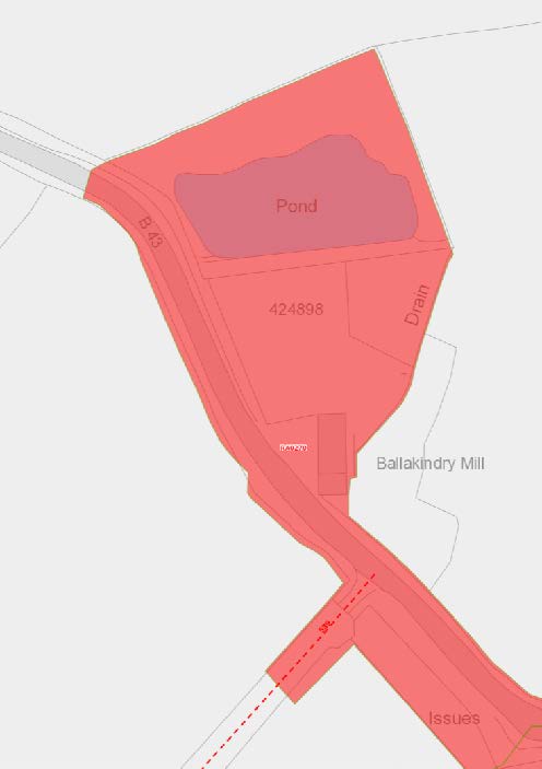
2.4 The building is not shown as being at risk of flooding (see right) although the lake is illustrated on the flood risk maps along with the road which is shown as being at risk of surface water flooding from the field to the north: the building itself is not at risk nor any land immediately around it.
2.3 Development which is harmful to trees is presumed against (Environment Policy 3) as is development that adversely affects wildlife (Environment Policies 4 and 7).
2.5 The trees on the site are Registered - RA0270 (see below).
2.6 There are policies which allow for the renovation and conversion of existing redundant buildings in the countryside (Environment Policy 16 and Housing Policy 11). These specifically require that eligible buildings are redundant for their original purpose, are of historic, social or architectural interest, are structurally capable of being converted, are of sufficient size to accommodate a dwelling either as they stand or with modest, subordinate extension which does not affect adversely the character or interest of the building; where residential use would not be incompatible with adjoining established uses or, where appropriate, land-use zonings on the area plan; and where the building is or can be provided with satisfactory services without unreasonable public expenditure.
2.7 Work to pre-1920 buildings should use traditional materials (Environment Policy 34).
2.8 Despite a number of mills being identified in the Area Plan for the South Written Statement, as being
of architectural, social or historic interest (Scholaby, Smelt, Cregg and Abbey) and some already being Registered (Witches, Golden Meadow), Ballakindry Mill is not identified as being of sufficient interest to warrant consideration for Registration.
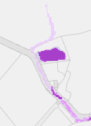
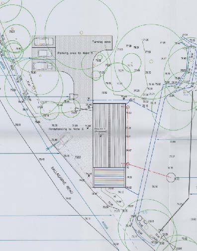
This image displays a site plan or map featuring a large purple polygon representing a building footprint and a smaller linear purple shape, likely indicating a boundary or drainage feature.A site plan showing the red-shaded boundary of Ballakindry Mill, highlighting a pond, drain, and proximity to the B43 road.
2.9 General Policy 2 sets out general standards with which development is expected to comply, including some of the issues already referred to above, and matters relating to access, highway safety, preservation of the character of an area.
2.10 Development will be expected to comply with all of these policies unless it can be demonstrated that there is justification for departing from them and mitigation or compensation of any adverse impact will normally be expected as part of the proposal.
3.0 Planning history
3.1 The site has been the subject of applications for conversion to a dwelling, which were approved: 05/01192/B, 16/01283/B and 17/00725/B, the latter of which expired on 03.07.22 although work did commence on the approved scheme prior to this with close liaison with Building Control Officers of the Department:
3.2 The Highway Services Division of Department for Infrastructure objected to this application on the basis that the provisions for access were not safe. However, the planning officer concluded that “There needs to be a balance of all of these factors and considering them all, it is recommended that whilst there is unsatisfactory visibility from and of vehicles emerging from the site, it is considered that the benefit of retaining this building of interest, together with the nature of the additional traffic which would be using the access, the balance should fall in favour of the application.”
3.3 Most recently, permission was refused for the conversion of the building to a dwelling: 21/01258/B was refused for the following reasons:
1. The site is not zoned for development and the building is not within a named settlement and in accordance with the settlement hierarchy, would encourage unsustainable development. Accordingly it is considered contrary to Strategic Policy 2 and 10 and also Spatial Policy 4*, of the Strategic Plan.
I think this should refer to Spatial Policy 5
2. Although an argument could be made that the existing building is of sufficient interest to warrant its retention and conversion, the extent of the structural works required with the intervention to the fabric of the building to make the structure sound coupled with the unacceptable upwards extension, the overbearing rear extension, the inappropriate modifications to the existing apertures and spread of hard standing and domestic curtilage would have a significant and adverse impact on the original appearance, character, historic interest and materials of the original building contrary to General Policy 3 (b) and Housing Policy 4b and Housing Policy 11.
3. The proposed extension is much larger than 50% which results in a built form that would not be subordinate to the existing building and would be viewed as inappropriate development which would see a loss of its individual character which does not respect the proportion, form and appearance of the existing Mill property and would be contrary to Housing Policy 15.
4. The application site is not zoned for development and is within an area of countryside. The proposed alterations and extensions and the subsequent introduction of large areas of hard standing would result in an unacceptable visual impact on the wider rural landscape and countryside setting of the site contrary to Environment Policy 1 and paragraphs 8.10.1 and 8.10.2.
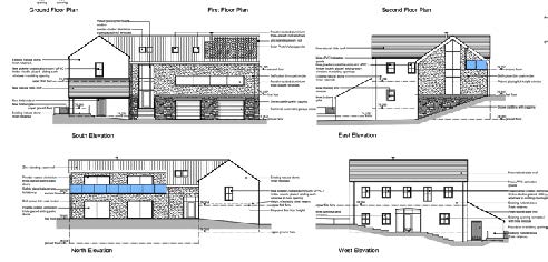
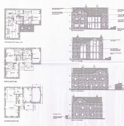
The image displays four architectural elevations (West, South, East, North) of a proposed stone building conversion.A site layout plan showing a proposed dwelling footprint, parking area, and turning circle with contour lines and landscaping details.
5. The design, size and scale of the proposed extension, and its finishes, are not sympathetic to the rural character of the area and is considered over development with an adverse visual impact that affects the character of the setting, contrary to Strategic Policy 5 and General Policy 2 (b & c) of the Strategic Plan.
6. The use of the proposed entrance in a safe and appropriate manner would create an adverse impact on the existing highway or upon those users entering and or exiting the site contrary to the principles of General Policy 2(h&I) and Transport Policy 4 of the Strategic Plan (2016).
7. The proposed loss of trees would adversely affect the character and would detrimentally affect the public amenity value of this collection of trees where the proposals do not enhance or protect the landscape quality and nature conservation value to this site and hence the proposal is contrary Environment Policy 3 and Strategic Policy 4(b) of the Strategic Plan (2016).
8. There is insufficient information available to understand the impact of the development on the adjacent watercourse contrary to Environment Policy 7 and General Policy 2l.
3.4 This application generated objections from a number of statutory consultees. In particular, Manx National Heritage were critical of the proposal in terms of the sizes and nature of alterations to existing openings, the insertion of new apertures particularly at the upper level, the fundamental alteration of the proportions of the building, the introduction of large stairwell openings which would obliterate the aperture of the waterwheel axle and the mass of the proposed extension.
3.5 There was also objection from the Highway Services Division of Department for Infrastructure in respect of the proposed dual access and when the access proposals were reduced to a single access point, they remained concerned that the visibility to the north was deficient and was not shown correctly on the drawings (splays drawn to the centre line not the nearside of the carriageway). They were also concerned about a new wall being built on the highway and how surface water would be prevented from flowing onto the highway.
3.6 Arbory Parish Commissioners objected to the application on the basis of a number of issues - ecology (bats), access, the illegitimacy of the additional access, the insensitivity of works undertaken to date and flood risk.
3.7 The Arboricultural Officer of Department of Environment, Food and Agriculture commented that works had been undertaken on site which was harmful to retained trees (lack of fenced protection and piling of earth and disturbance within the Construction Exclusion Zones shown on the previously approved applications. Further tree removal was approved on the basis of replanting of new trees (38 approved for removal and 29 to be planted). It was their view that additional trees had been removed, possibly due to the need for the undertaking of works to address drainage issues of the leaking pond and failure of a roadside culvert to function. The resulting works were, in his opinion, engineering operations which required planning approval. The additional tree proposed to be removed as part of the application was not justified. He estimated that the canopy cover has been reduced from 75% of the site to nearer 25% and no new generation of trees coming through to eventually replace those trees which have been removed. As such, any additional tree removal is unacceptable. He is clear that the impact on trees is not from the conversion of the building but from the grade changes to the rest of the site.
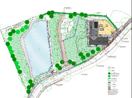
A detailed site plan illustrating a property layout featuring a large lake, a building footprint, and surrounding landscaping with trees.This image displays a set of architectural floor plans and elevations for a building conversion project, detailing the ground, first, and second floors.
2015 aerial photograph 2018 aerial photograph
3.8 The mill dam was reclaimed for use as a fishing pond under 85/00528/B. Other sites
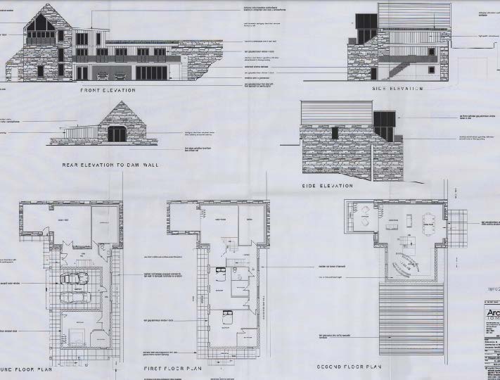
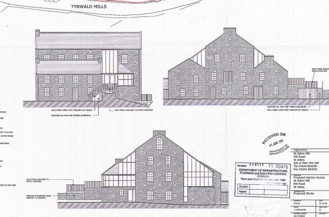
3.9 Whilst cognisant of the relevant policies, particularly in respect of the size and style of extensions, it is also relevant to consider approved schemes for other redundant rural buildings. In particular, the approved scheme for Scholaby Mill which is referred to in the Area Plan as eligible for consideration for Registration is identified, as well as Tynwald Mill in St. John’s, a Registered Building, Tuck Mill in Onchan and The Granary, a large house at Balladoole. Whilst the last site is not a mill, it is architecturally and in terms of its size and height, untypical of most residential buildings in the countryside and is a striking building of historic interest. The policies which guide the extension of existing rural dwellings of traditional character also, like Housing Policy 11, advise that extensions respect the form, appearance and proportion of the existing.
An aerial view of a rural site featuring a building surrounded by dense trees and a small pond, situated between green agricultural fields.An aerial view of a rural site showing a building complex next to a pond, surrounded by green fields and an access road.
Scholaby Mill 18/00219/B
Tynwald Mill, St. John’s (RB 83) approved for extension and conversion to offices under 00/01131/B
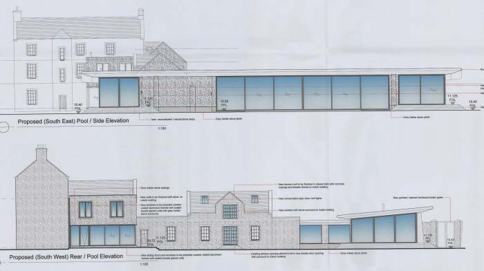
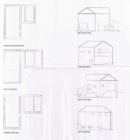
The image displays a set of architectural drawings including front, side, and rear elevations of a stone building, alongside ground, first, and second-floor plans.Architectural elevations and perspective sketch of a stone mill building showing proposed modern glass and steel extensions.
The Granary, Balladoole, Arbory 17/01196/B
Tuck Mill, Onchan 12/00314/B
Architectural elevation drawings illustrating the proposed side and rear views of a converted mill with a modern glass extension.The image displays a set of architectural drawings including floor plans for the ground, first, and second floors, alongside south, north, and west elevations of a stone building.The image displays a set of architectural drawings including floor plans for the ground, first, and upper levels, alongside four elevations (South, East, North, West) of a building.
4.0 The proposal
4.1 Following the previous refusal, the owners have started from the beginning and have reduced the amount of additional space they would like and have approached the scheme with a view to create a habitable dwelling, retaining the character and layout of the existing building and making the new fabric distinctly different, lower and smaller, following the examples given above.
4.2 Planning permission is being sought for the following works:
•Conversion and extension of the existing mill building to provide a single residential dwelling
•Creating of a single access point to serve the site, closing off the existing opening to the south of the building with a new sod hedge
•Creation of a new hard surfaced car parking area and access drive (stone chippings)
•Installation of a bank of twelve solar panels to the north of the building
•Retrospective approval for the re-profiling of the bank between the mill and the lake which was undertaken to address leakage from the pond
•Installation of a new Klargester biodisc sewage treatment plant to the south east of the building
•Landscaping of the site including the formation of a construction exclusion zone during works to protect existing trees, all of which are to be retained
4.3 Conversion of the existing building to a dwelling
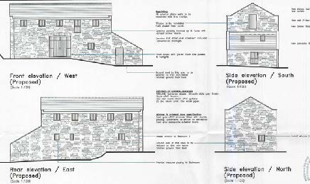
4.3.1 The existing building will be retained as it currently exists: the upper floor window cill levels have been raised by 300mm to accommodate the structural elements required to preserve and retain the building for its new use, particularly due to the height of the first floor beams (set approx at 10ft from the ground floor) which meant that windows if left at that height would have been to low for a dwelling remembering that these windows originally allowed light into what was then a threshing mill.. The front elevation will otherwise be retained as existing with glazing inserted into the large existing opening on the ground floor and the brick arch retained above. The existing openings will be respected and fitted with simply glazed side hung casements and a single light in the door length opening on the first floor. The roof will be reformed and finished in Redland Cambrian reconstituted slates with two black aluminium Conservation style roof lights in the mono pitch roof on the lean to annex to the south. Window frames will be black aluminium.
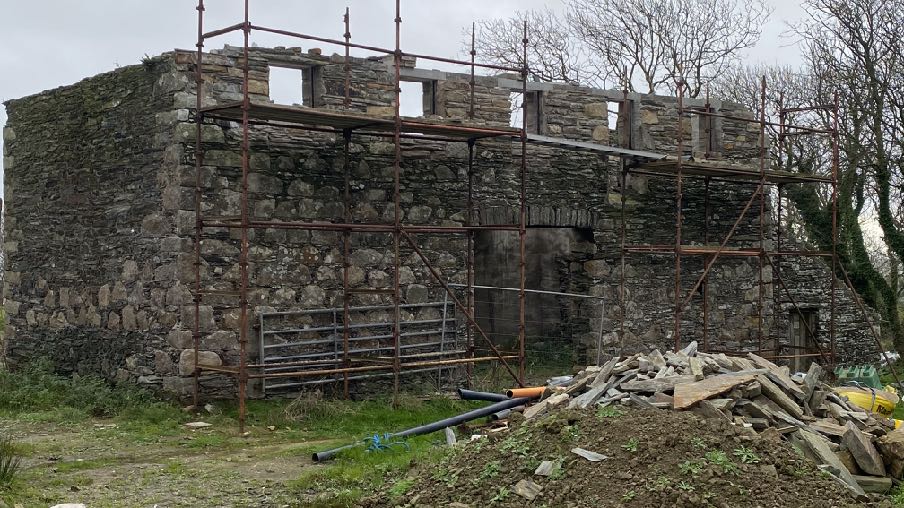
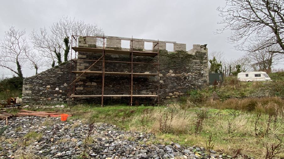
A photograph showing a large stone building, likely a former mill, covered in scaffolding during a renovation project. Construction debris and pipes are visible in the foreground.
4.3.2 The former window opening in the southern elevation, first floor will be re-introduced.
4.3.3 The northern elevation will see a new full length opening introduced and a simple fixed light inserted.
4.3.4 On the rear there are currently no openings on the ground floor and five apertures in the first floor. Due to the addition of a new annex and the internal arrangement, all but one of the first floor openings will be blocked up or incorporated into the new annex with the southern most opening retained as a window. On the ground floor, one small additional opening is to be introduced.
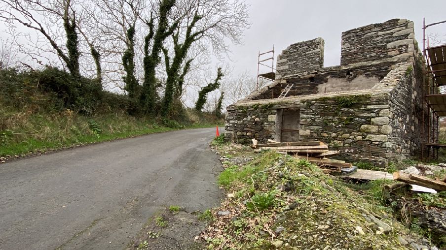
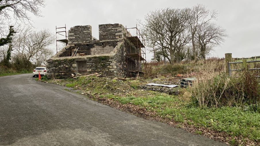
A photograph showing a stone mill building under renovation with scaffolding, situated next to a rural road.A photograph showing a stone building under renovation with scaffolding erected on the upper wall section. The foreground features a gravel area and the background includes vegetation and a caravan.
4.3.5 The new annex will be to eaves height of the main building and slightly narrower in width than the main building. It has deliberately been finished to contrast with the main building, to emphasise the dominance and originality of the main building, and following the approach taken at Tynwald Mills, Scholaby Mill and The Granary in the use of modern and contrasting materials. The extension will be simple in form and finish with untreated Western red Cedar vertical cladding with a zinc standing seam roof system and black flue running up the gable. The elevation faving south will have vertically proportioned windows and doors with eaves level peaks to add some internal head height to the en-suite bathroom, lobby and bedroom contained in this space.
4.3.6 The new annex is set back from the northern gable of the existing building to improve its appearance, emphasis the subordinate character and avoid damage to the adjacent tree to the north and an exclusion zone including this tree is shown on the plans. The annex will be built into the bank alongside at this point.
4.3.7 There will be small patio in front of the annex which extends to the southern extent of the existing two storey element of the mill with the single story lean to annex extending further south than this and screening it from all but the view into the site from the south. This will be further screened by the introduction of a new sod hedge along this currently open area alongside the road.
4.3.8 The existing mill has a floor area of 217 sq m measured externally. The proposed extension has a floor area of 125 sq m and is therefore an increase of 57.6%. Housing Policy 11 does not quantity what “modest” or “subordinate” are although Housing Policy 13 which refers to the renovation of existing residential properties, also refers to “subordinate” and clarifies that this is less than 50% of the original floor space. Housing Policy 15 also refers to 50% increases in floor area, considering this not to be “substantially different to the existing”. Whilst over the 50% margin, it is relevant that the extension is 1.8m lower than the main building, its ridge is no nigher than the eaves of the main building and its width is less than that of the main building to which it will be attached.
4.4 Access
4.4.1 Currently access is available directly in front of the building in a wide, opening onto the highway. This is to be closed off as the visibility to the south is significantly impaired by the existing single storey lean to on the southern gable of the building.
4.4.2 Visibility is improved as one proceeds northwards and further from the bend to the south and equidistant between that and the one to the north. It should be noted that due to the winding nature of the Ballagawne Road, traffic tends to travel relatively cautiously. Pre-application discussion with the Highway Services Division of Department for Infrastructure confirmed that the northernmost access is the preferred positions as it affords the greatest visibility (e-mail correspondence with Adam Dunlop dated 10th and 11th November, 2022).
A photograph showing a stone mill building under construction with scaffolding, located beside a paved road in a rural setting.
4.4.3 The access will be 5m wide and with splays of 40m in each direction enabled by the lowering of the height of the roadside boundary to no higher than 1050mm above road level and with compensatory planting of native species behind this, retaining the screening effect but not interfering with the visibility of and from the entrance. The existing openings in front of and to the south of the building will be closed off with new sod banks.
4.5 Creation of a new hard surfaced car parking area and access drive (stone chippings)
4.5.1 The applicants would like to have car parking and turning space and also the ability for vehicles to drive up to the front of the building including the lean to which may be used to accommodate a utility room which could accommodate facilities which need servicing (boiler, heating system equipment) and where access would be very useful. The applicants appreciate the potential visual impact of having this additional hard surfaced area and as such are proposing additional planting of native species (hawthorn/blackthorn) which will also compensate for the lowering of the existing roadside hedge and provide additional privacy and sound insulation for the occupants of the building.
4.5.2 Stone chippings, rather than paviours, concrete or tarmacadam is considered a more sympathetic finish in this location and will assist with surface water percolation.
4.6 Installation of a bank of twelve solar panels to the north of the building
4.6.1 The applicants are aware of the non sustainable location of this site and would wish to be as environmentally friendly as possible and incorporate renewable energy as far as is practicable and visually acceptable. Twelve solar panels are proposed to be located on the bank (see below).
4.7 Retrospective approval for the re-profiling of the bank between the mill and the lake which was undertaken to address leakage from the pond
4.7.1 This work was undertaken to deal with water which was leaking from the lake down towards the mill. This work was done as an emergency as water was leaking from the lake and water logging the ground to the south and its trees as well as the mill building. Liaison with Department of Environment, Food and Agriculture’s Inland Fisheries Division confirms that they visited the site and have no objections to this work from a fisheries perspective (see e-mail of 13.04.22 sent to the applicant and the Planning Officer was copied in, in respect of 21/01258/B).
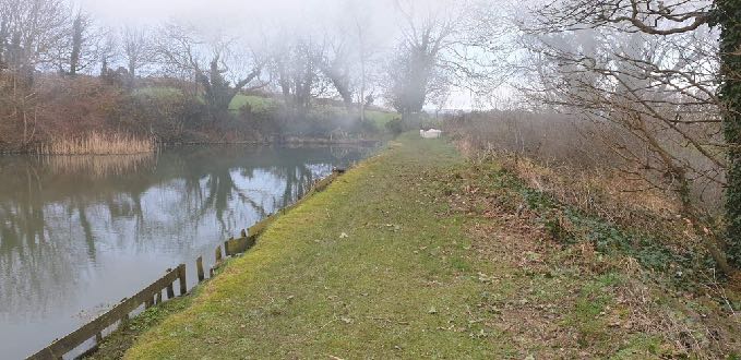
4.7.2 The photographs below show the site prior to and during the works: before at 3m wide (right)
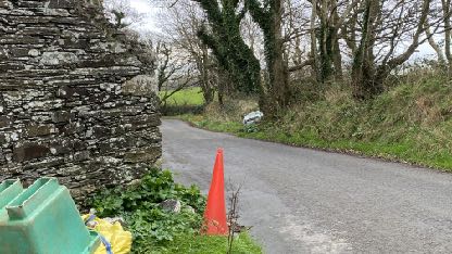
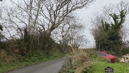
A street-level photograph showing a paved road curving past a rough stone wall on the left, with trees and vegetation in the background and a traffic cone in the foreground.A photograph of a narrow rural lane with trees and vegetation, showing a red car parked on the grass verge and a 'Private Road' sign.A photograph showing a grassy bank running alongside a body of water, likely the existing lake mentioned in the application, with trees and a wooden fence visible.
After at 6m wide
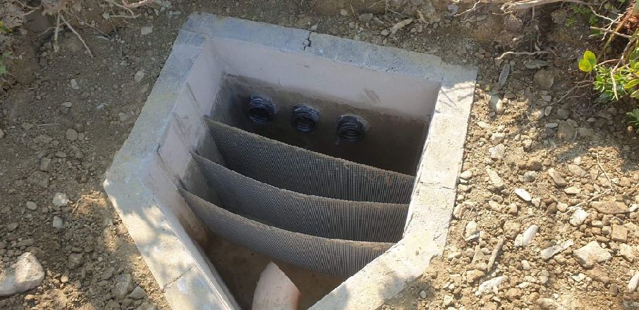
The works incorporate a fish trap with triple layered filters and three exit drains to a roadside ditch
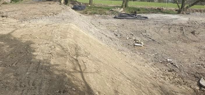
A photograph showing a construction site with earthworks, a mound of sand or soil, and black drainage pipes lying on the ground near trees.A photograph showing a concrete drainage chamber or soakaway installed in the ground with mesh filters and inlet pipes.
There is also a pond overflow inlet pipe to the fish trap and a roadside ditch pipe receiving the three exit drains (below)
4.8 Installation of a new Klargester biodisc sewage treatment plant
4.8.1 This is to be installed to the south was of the building and will comply with the requirements of the Building Regulations.
4.9 Landscaping of the site including the formation of a construction exclusion zone
4.9.1 The site will be subject to a landscaping scheme which will increase the natural screening of the site and increase the biodiversity value of the area. The previous application proposed the removal of an existing large sycamore tree to the north of the mill which was the subject of objections from the Department’s Arboricultural Officer. He also clarified that through the combination of previous planning approvals and felling licences, permission has been granted for the removal of 38 trees and whilst they were concerned about the removal of more than this, they visited the site in August 2021 and decided that no further action was required at that time. They noted, however, at this meeting that significant re-grading of the site had been undertaken to address the water issues from the lake, and that this, which constituted engineering operations, has impacted on the construction exclusion zone for some of the trees which were to be retained.
4.9.2 He confirms that the trees which have been planted corresponds to the number required in the licence application 044/21 dated March 2021 which has been extended to require the trees to be planted by March 2024.
4.9.3 It is no longer proposed to remove any further trees from the site than currently exist and the extension has been moved further from the sycamore referred to in the previous application to ensure its continued presence on the site.
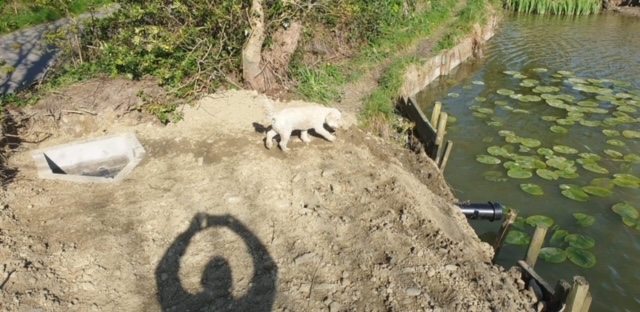
A photograph showing a reinforced earth bank next to a lake with lily pads and a concrete drainage outlet.
5.0 Assessment
5.1 Having regard to the most recent application, comments submitted and the decision, it would appear that there is continued support, following the previous approvals, for the principle of the renovation of this building to provide a dwelling, having particular reference to the Planning Officer’s report paragraphs 6.7a, b and c and the Planning Committee minutes state that they were concerned with the size of the extension, not the principle of it, which is helpful.
5.2 The issues then appear to be how the building is converted both in terms of how the existing building is treated and any extensions thereto (size and appearance and impact on the original building). In addition, there appear to be or have been issues in respect of highway safety, the treatment of the land around the building, hard surfacing and trees.
5.3 Finally, there appeared to be concern about the impact of any development on the adjacent watercourse. We think this relates to the comments in the Planning Officer’s report as follows although the preceding paragraph appears to confirm that there is no issue and the receiving ditch is capable of accommodating any run off:
6.25 However there lies the concerns as the amount of hard surfaces being created through roofs and hard landscaping, ie non permeable surfaces, and the lack of any surface water drainage mitigation measures, means this could put additional pressure on the existing ditch and as the Commissioners have already identified by the over flow from the pond being diverted and would exacerbate any flood risk to those lower down the stream which has not been taken into consideration at this stage. As such it has not been demonstrated there would be no unreasonable risk of flooding or flood risk resulting from the proposed development and could be considered contrary with GP2l, Ep7.
5.4 It is relevant that in the present proposal, the only additional hard surfaces on the new application would be the additional roof of the extension, all other areas are now going to be gravelled rather than using tarmac therefore, exactly the same
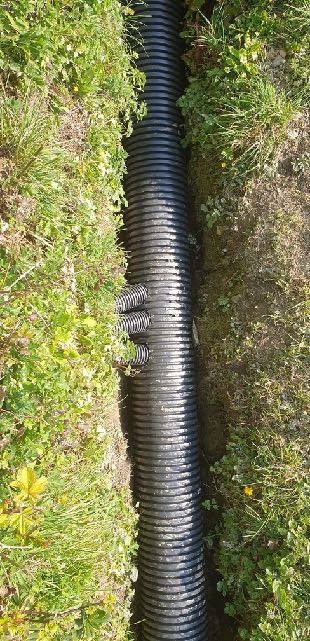
A vertical photograph showing a black corrugated drainage pipe installed in a grassy trench, with smaller branch pipes visible.
amount of rainfall as presently runs in to the roadside ditch to the south of the property will be exactly the same volume of water that will run off in to the very same roadside ditch once any extension is built
5.5 More positively, there were no issues regarding the impact of the development on ecology and the amenities of those in nearby dwellings. It is also accepted that the building is redundant for its original purpose, could be converted and is worthy of consideration for conversion all as required by Housing Policy 11 (Planning Officer’s report paragraphs 6.7a, b and c).
5.6 This latest scheme seeks to address these concerns through:
The reduction in area of hard standing and remediation of the leakage from the lake (flood risk) The reduction in size and change in design of the extension The alteration of the proposed means of access to a position which maximises visibility splays The retention of the sycamore and all other existing trees on site The closing up of existing openings in the roadside boundary and the introduction of native hedging and sod banks
5.7 The existing building will remain as it is/originally was; the extension is smaller and lower than the existing building and not significantly more than 50% of the existing floor area. Whilst the appearance and materials of the extension contrast with those of the main building to which it would be attached, we have demonstrated with the reference to other positively considered applications, that this approach is neither uncommon nor unacceptable, depending upon its merits.
5.8 The application avoids further tree loss and retained trees should not be affected by the design or location of the proposal.
5.9 The proposal minimises new hard surfacing for both visual and surface water reasons.
5.10 Access is clearly difficult and whilst this was a reason for refusal, previous approvals have accepted that the full visibility splays are probably not possible at all and if they are, not without significant and adverse visual changes. In previous applications the benefit of using and saving the existing building was considered to outweigh the deficiencies in access provisions. We have liaised with the Highway Services Division of Department for Infrastructure and are now proposing an access in the position which affords the greatest visibility and are closing off the other alternatives which will be of benefit to both the appearance of the area and highway safety.
5.11 Whilst the works to the bank to address the water leakage should have had planning approval, the applicants were concerned about the impact of the water on the stability of the site and potential damage to trees and the building. As such, they continued with the required works without first securing planning approval. We now seek that permission and would add that the unremedied situation may have had a fatal impact on the building as well as the trees which were lost as a result of the works and with a further threat to the remaining trees which are now to be retained. We would suggest that the new bank does not have an adverse impact on the character or appearance of the area.
5.12 We would hope that this revised scheme is now considered to accord with the relevant planning policies and will secure the future of an interesting and publicly visible building in the interests of the character of the countryside. The applicants would be happy to accept conditions which suspend the the Town and Country Planning (Permitted Development) Order 2012 in respect of garages, sheds, extensions, walling and fencing between the building and the highway and for the required tree protection to be in place prior to the continuation of any works on site.
Sarah Corlett 20.02.2023
Appendix One - Strategic Plan policies
Strategic Aim: To plan for the efficient and effective provision of services and infrastructure and to direct and control development and the use of land to meet the community’s needs, having particular regard to the principles of sustainability whilst at the same time preserving, protecting, and improving the quality of the environment, having particular regard to our uniquely Manx natural, wildlife, cultural and built heritage.
Strategic Policy 1: Development should make the best use of resources by: (a) optimising the use of previously developed land, redundant buildings, unused and under-used land and buildings, and reusing scarce indigenous building materials; (b) ensuring efficient use of sites, taking into account the needs for access, landscaping, open space(1) and amenity standards; and (c) being located so as to utilise existing and planned infrastructure, facilities and services.
Strategic Policy 2: New development will be located primarily within our existing towns and villages, or, where appropriate, in sustainable urban extensions(2) of these towns and villages. Development will be permitted in the countryside only in the exceptional circumstances identified in paragraph 6.3.
Strategic Policy 4: Proposals for development must: (a) Protect or enhance the fabric and setting of Ancient Monuments, Registered Buildings(1), Conservation Areas(2) , buildings and structures within National Heritage Areas and sites of archaeological interest; (b) protect or enhance the landscape quality and nature conservation value of urban as well as rural areas but especially in respect to development adjacent to Areas of Special Scientific Interest and other designations; and (c) not cause or lead to unacceptable environmental pollution or disturbance.
Strategic Policy 5: New development, including individual buildings, should be designed so as to make a positive contribution to the environment of the Island. In appropriate cases the Department will require planning applications to be supported by a Design Statement which will be required to take account of the Strategic Aim and Policies.
Strategic Policy 10: New development should be located and designed such as to promote a more integrated transport network with the aim to: (a) minimise journeys, especially by private car; (b) make best use of public transport; (c) not adversely affect highway safety for all users, and (d) encourage pedestrian movement
Spatial Policy 5: New development will be located within the defined settlements. Development will only be permitted in the countryside in accordance with General Policy 3.
General Policy 2: Development which is in accordance with the land-use zoning and proposals in the appropriate Area Plan and with other policies of this Strategic Plan will normally be permitted, provided that the development: (a) is in accordance with the design brief in the Area Plan where there is such a brief; (b) respects the site and surroundings in terms of the siting, layout, scale, form, design and landscaping of buildings and the spaces around them; (c) does not affect adversely the character of the surrounding landscape or townscape; (d) does not adversely affect the protected wildlife or locally important habitats on the site or adjacent land, including water courses; (e) does not affect adversely public views of the sea; (f) incorporates where possible existing topography and landscape features, particularly trees and sod banks; (g) does not affect adversely the amenity of local residents or the character of the locality; (h) provides satisfactory amenity standards in itself, including where appropriate safe and convenient access for all highway users, together with adequate parking, servicing and manoeuvring space; (i) does not have an unacceptable effect on road safety or traffic flows on the local highways; (j) can be provided with all necessary services; (k) does not prejudice the use or development of adjoining land in accordance with the appropriate Area Plan; (l) is not on contaminated land or subject to unreasonable risk of erosion or flooding; (m) takes account of community and personal safety and security in the design of buildings and the spaces around them; and (n) is designed having due regard to best practice in reducing energy consumption.
General Policy 3: Development will not be permitted outside of those areas which are zoned for development on the appropriate Area Plan with the exception of:
(a) essential housing for agricultural workers who have to live close to their place of work; (Housing Policies 7, 8, 9 and 10);
(b) conversion of redundant rural buildings which are of architectural, historic, or social value and interest; (Housing Policy 11);
(c) previously developed land(1) which contains a significant amount of building; where the continued use is redundant; where redevelopment would reduce the impact of the current situation on the landscape or the wider environment; and where the development proposed would result in improvements to the landscape or wider environment;
(d) the replacement of existing rural dwellings; (Housing Policies 12, 13 and 14);
(e) location-dependent development in connection with the working of minerals or the provision of necessary services;
(f) building and engineering operations which are essential for the conduct of agriculture or forestry;
(g) development recognised to be of overriding national need in land use planning terms and for which there is no reasonable and acceptable alternative; and
(h) buildings or works required for interpretation of the countryside, its wildlife or heritage.
Environment Policy 1: The countryside and its ecology will be protected for its own sake. For the purposes of this policy, the
countryside comprises all land which is outside the settlements defined in Appendix 3 at A.3.6 or which is not designated for future development on an Area Plan. Development which would adversely affect the countryside will not be permitted unless there is an over-riding national need in land use planning terms which outweighs the requirement to protect these areas and for which there is no reasonable and acceptable alternative.
Environment Policy 3: Development will not be permitted where it would result in the unacceptable loss of or damage to woodland areas, especially ancient, natural and semi-natural woodlands, which have public amenity or conservation value.
Environment Policy 4: Development will not be permitted which would adversely affect:
(a) species and habitats of international importance:
(i) protected species of international importance or their habitats; or (ii) proposed or designated Ramsar and Emerald Sites or other internationally important sites.
(b) species and habitats of national importance:
(i) protected species of national importance or their habitats;
(ii) proposed or designated National Nature Reserves, or Areas of Special Scientific Interest; or
(iii) Marine Nature Reserves; or
(iv) National Trust Land.
(c) species and habitats of local importance such as Wildlife Sites, local nature reserves, priority habitats or species identified in any Manx Biodiversity Action Plan which do not already benefit from statutory protection, Areas of Special Protection and Bird Sanctuaries and landscape features of importance to wild flora and fauna by reason of their continuous nature or function as a corridor between habitats.
Some areas to which this policy applies are identified as Areas of Ecological Importance or Interest on extant Local or Area Plans, but others, whose importance was not evident at the time of the adoption of the relevant Local or Area Plan, are not, particularly where that plan has been in place for many years. In these circumstances, the Department will seek site specific advice from the Department of Agriculture, Fisheries and Forestry if development proposals are brought forward.
Environment Policy 7: Development which would cause demonstrable harm to a watercourse, wetland, pond or dub, and which could not be overcome by mitigation measures will not be permitted. Where development is proposed which would affect a watercourse, planning applications must comply with the following criteria:
(a) all watercourses in the vicinity of the site must be identified on plans accompanying a planning application and include an adequate risk assessment to demonstrate that works will not cause long term deterioration in water quality;
(b) details of pollution and alleviation measures must be submitted;
(c) all engineering works proposed must be phased in an appropriate manner in order to avoid a reduction in water quality in any adjacent watercourse; and
(d) development will not normally be allowed within 8 metres of any watercourse in order to protect the aquatic and bankside habitats and species.
Environment Policy 16: The use of existing rural buildings for new purposes such as tourist, or small-scale industrial/ commercial use may be permitted where:
a) it is demonstrated that the building is no longer required for its original purpose and where the building is substantially intact and structurally capable of renovation;
b) the reuse of the building will result in the preservation of fabric which is of historic, architectural, or social interest or is otherwise of visual attraction;
c) it is demonstrated that the building could accommodate the new use without requiring extension or adverse change to appearance or character;
d) there would not be unacceptable implications in terms of traffic generation;
e) conversion does not lead to dispersal of activity on such a scale as to prejudice the vitality and viability of existing town and village services; and
f) the use of existing buildings involves significant levels of redevelopment to accommodate the new use, the benefits secured by the proposal in terms of impact on the environment and the rural economy shall outweigh the continued impact of retaining the existing buildings on site.
Proposals to convert rural buildings to residential accommodation will be considered along with the advice given at Section 8.10 of this document.
Environment Policy 34: In the maintenance, alteration or extension of pre-1920 buildings, the use of traditional materials will be preferred.
Housing Policy 4: New housing will be located primarily within our existing towns and villages, or, where appropriate, in sustainable urban extensions(1) of these towns and villages where identified in adopted Area Plans: otherwise new housing will be permitted in the countryside only in the following exceptional circumstances:
(a) essential housing for agricultural workers in accordance with Housing Policies 7, 8, 9 and 10;
(b) conversion of redundant rural buildings in accordance with Housing Policy 11; and
(c) the replacement of existing rural dwellings and abandoned dwellings in accordance with Housing Policies 12, 13 and 14. Housing Policy 11: Conversion of existing rural buildings into dwellings may be permitted, but only where:
(a) redundancy for the original use can be established;
(b) the building is substantially intact and structurally capable of renovation;
(c) the building is of architectural, historic, or social interest;
(d) the building is large enough to form a satisfactory dwelling, either as it stands or with modest, subordinate extension which does not affect adversely the character or interest of the building;
(e) residential use would not be incompatible with adjoining established uses or, where appropriate, land-use zonings on the area plan; and
(f) the building is or can be provided with satisfactory services without unreasonable public expenditure. Such conversion must:
(a) where practicable and desirable, re-establish the original appearance of the building; and
(b) use the same materials as those in the existing building.
Permission will not be given for the rebuilding of ruins or the erection of replacement buildings of similar, or even identical, form. Further extension of converted rural buildings will not usually be permitted, since this would lead to loss or reduction of the original interest and character.
Appendix Two - Landscape Character Assessment 2008 D14 – BALLAMODHA AND ST MARK’S Key Characteristics
• Land slopes down from the southern uplands towards the coast.
• Numerous deeply incised wooded river valleys and glens cut down into the landscape forming ribbons of fragmented woodland.
• National Glens at Silverdale and Colby
• Settled farmland character with some large nucleated settlements along the A7, small villages and a variety of scattered dwellings and farms.
• Smaller predominantly rectangular pastoral fields with Manx hedges topped with gorse on the upland slopes to the north.
• Patches of gorse, bracken and heather in fields on the upper slopes.
• Larger rectilinear pastoral and arable fields with large deciduous trees growing on Manx hedges on the more gently sloping southern slopes.
• Around the various settlements and farms there are smaller rectangular arable and pastoral fields with Manx hedgerows containing numerous trees and some stone walls.
• Network of tracks, small lanes and larger roads enclosed by substantial hedgerows containing deciduous trees all growing on grass covered Manx hedges.
• Numerous small reservoirs and water bodies associated with water courses.
• Some small churches with spires as well as various standing stones and other visible archaeological sites.
• Presence of Manx Milestones.
• Quarries at Turkeyland and at Billown.
Overall Character Description Land slopes steeply down from the southern uplands with small rectangular fields of rough pasture containing patches of gorse and some bracken in places where these upland species have spread out from the low Manx hedges. A variety of predominantly stone hill farms with numerous outhouses surrounded by fragmented woodland, such as Ballaglashan and Glenmoar Farm, are located on these steeper slopes. The tight geometric field pattern on these slopes loosens as the slope angle becomes shallower with larger, predominantly angular but irregularly shaped fields of grazing and agriculture covering the majority of the flatter southern area. Smaller fields surround the various small clustered settlements. There are also groups of trees surrounding these settlements (e.g. the more traditional village of St. Mark’s with its stone houses, church and conservation area) and also around loosely clustered dwellings such as those along the A34 north of Ballasalla. Located along the busy A7 road are the two larger nucleated settlements of Ballabeg and Colby whose traditional fabric has been added to with numerous modern extensions that back onto small fields with some screening in the form of mature trees in surrounding hedgerows.
Through this gently sloping and undulating landscape cut numerous steep sided deep and heavily vegetated river valleys, including Colby River, Silver Burn and Santon Burn, with numerous smaller tributaries joining their courses along with various rectilinear drainage ditches. These wooded valleys form sinuous fingers of fragmented woodland that cut across and disrupt the field pattern and otherwise gently sloping landform. Colby Glen and Silverdale Glen are designated both as conservation areas and National Glens. These glens were developed during the Victorian times to allow visitors waterside access and a chance to experience these enclosed valleys and their lush riparian vegetation by way of footbridges and paths with handrails to promenade. Many original features remain today.
A network of small tracks, narrow roads and larger A roads traverse the area and are predominantly contained by steep sided grassy banks of the Manx hedgerows that line the roads, with varying hedgerows, some containing trees in places. There is a settled but semi-rural character. There is a relatively strong sense of tranquillity that pervades much of the area. Wooded horizons are common in most places, creating an intimate contained and continuous character. The steep sided Glens break what would otherwise be a relatively monotonous landscape to create active and dramatic elements that one can descend down into from the surrounding fields.
Key Views
• Distant views prevented at times by dense woodland in river valleys and by the cumulative screening effect of hedgerow trees, which tend to create wooded horizons.
• Open and panoramic views out to sea from the higher areas on the upper western parts of the area where there are few trees to interrupt views. Historic Features
• Numerous chapels and churches including Columbus Church and Kirk Santon with Medieval crosses
• Standing stones and some earthworks
• Rushen Abbey (Cistercian) and Monks Bridge
• Silverdale watermill and roundabout Ecological Features
• Farmland grassland habitats
• Mature network of hedgerows containing deciduous trees in field boundaries
• Aquatic and waterside habitats along river courses
• Dense riparian woodland in Glen bottoms • Fragmented blocks of deciduous woodland
• Bird sanctuary at junction of A34 and A3 Evaluation of Inherent Landscape Sensitivities
• Mixture of field size and pattern with various hedges containing a variety of vegetation.
• Fragmented woodland in valley bottoms and along National Glens.
• Rivers and reservoirs with aquatic ecosystem with riparian habitats.
• Built up edge of Ballasalla and nucleated settlements of Ballabeg and Colby.
• Scattered traditional farms and hamlets fringed by deciduous woodland.
• Network of tracks, small lanes and larger roads enclosed by substantial hedgerows containing deciduous trees all growing on grass covered Manx hedges.
• Sites of archaeological importance.
• Manx Milestones by roadside.
• Victorian Isle of Man Steam Railway station and halts.
Landscape Strategy The overall strategy for the area should be to conserve and enhance the character, quality and distinctiveness of this farmed landscape with various field patterns defined by different hedges, a scattered settlement pattern of traditional hamlets, farmsteads and nucleated settlements fringed by trees, a varied road network enclosed by grassed Manx hedges and roadside vegetation, and numerous wooded valleys and glens. In addition to the conservation of archaeological sites, measures should also be adopted to conserve and enhance the physical structure and setting of upstanding heritage features such as the Silverdale watermill.
Copyright in submitted documents remains with their authors. Request removal